What EGLE’s Wetland Report Tells Us About the Seventh Street Development
Michigan’s Department of Environment, Great Lakes, and Energy, otherwise known as EGLE, has released their wetland report for the proposed Seventh Street Development.
A wetland specialist with EGLE spent several hours assessing the site on August 18, accompanied by the individual who completed the original wetland survey for the developer, Adam Rogalski.
Here’s what we know and don’t yet know.
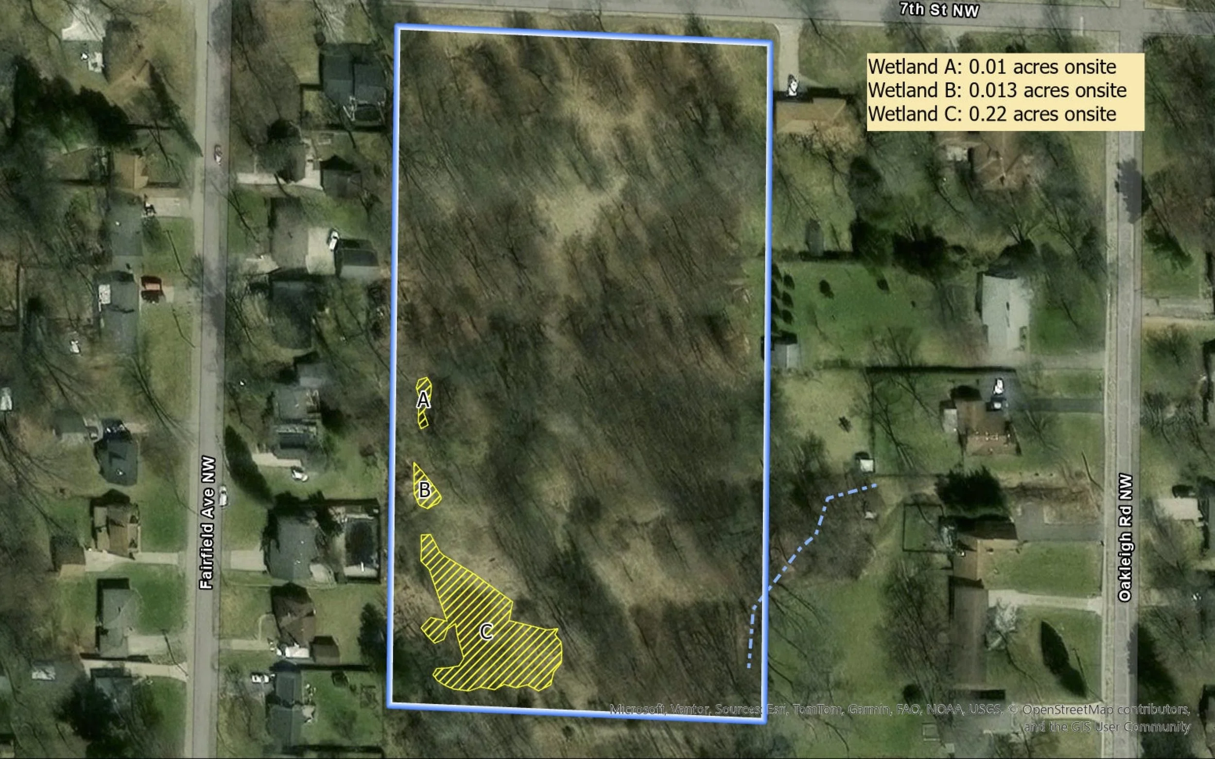
Updated image from EGLE, showing the size and location of wetlands on the Seventh Street lot
The existing wetlands are bigger than the developer’s delineation suggested.
EGLE’s report establishes that the two southernmost wetlands are actually one larger wetland. This is noteworthy, given the developer’s track record of trying to downplay the wetlands’ size and significance.
Initially, Adam Rogalski tried to argue there weren’t any wetlands on the site—and that neighbors concerns were overblown. Of course, as is now clear, his own wetland survey proved neighbors right and the developer wrong.
Still he tried to downplay the significance of the wetlands. At the July 9 Planning Commission, Rogalski testified that the wetlands comprised “less than one tenth of an acre.”
This was false, according to his own wetland survey, which put the size of the wetlands well over this amount.
Now EGLE has confirmed the delineated wetlands are, in fact, 40% larger than suggested by the developer’s report.
EGLE did not identify any new wetlands in their report.
To be clear, EGLE’s report confirms the already delineated wetlands are larger than initially suggested. It does not say anything about the existence of additional wetlands. Whether they assessed other sample points from the developer’s delineation is unclear—there were at least two that merited a closer look.
One way or the other, EGLE’s report serves as the final regulatory word on the presence of wetlands on the site.
Neighbor concerns, initially dismissed by the developer, have been validated.
It’s not clear yet what impact the revised wetland boundaries could have on the developer’s site plan.
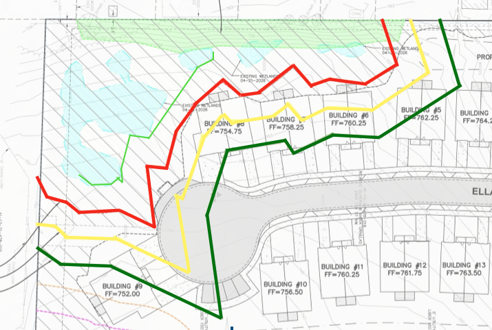
Site plan showing the approximate northern boundary of the wetlands, confirmed by EGLE (light green line), relative to the 25-foot buffer (red line).
EGLE’s delineation appears to extend the wetland boundaries slightly northward, which would bring them closer to at least one of the proposed units and part of the cul-de-sac. Whether or not that’s enough to encroach on the 25-foot buffer the Planning Commission voted to allow remains to be seen. If it does cross the 25-foot buffer, that should force the developer to make at least some adjustments to his plans.
Regardless, a 25-foot buffer was never adequate protection—even less so, now that we know the wetlands are larger than initially delineated. At the Planning Commission hearing, Planning Director Kristin Turkelson admitted wetlands with 25-foot buffers are frequently contaminated by construction.
Imposing a 50- or 75-foot buffer is the only responsible course of action. Unfortunately, it’s one the Planning Commission chose not to take.
